Although I do enjoy staying at Ryokans like Takinoya, Noboribetsu and Shiosai-no-yado Seikai (潮騒の宿 晴海) because of the great hospitality, there is one thing that I kind of miss whenever I go, and that is having a gym facility on site that allows me to go for a decent run to burn off those great meals that the places offer.
As a result of being overfed and not enough exercise, Ms Buddha and I tend to try and fit in long walks or even purposely take the long route to add a few more steps in. Which is why we chose to hike up Mt Yufu as part of the day trip.

The road to the entrance of the hiking trail is actually a little discrete, but given that there is only one road, if you go to the visitor center on the map above and then head back towards East, you will find it within a few minutes drive.
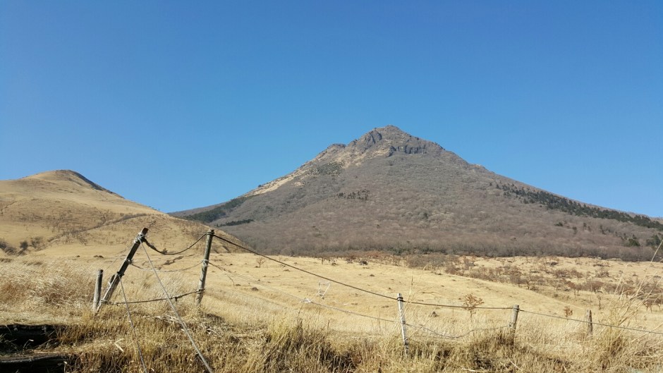
Mt Yufu is also known as the twin peaks mountain, as its name suggest, there are two summits of sorts, with clearly defined paths either sides of the mountain and between the peaks.
On the day we were there, the sky was completely blue but it was a bit cold and windy, although given that it was an uphill walk from the very start, by the time I reached the entrance, I was already warmed up and had to strip down to just a T-shirt (temperature was about 5 degrees or so).

Once you’ve entered the official start of the way up the mountain though, you’re shielded from the wind by the trees.
Now I have to say that I’m not an enormous fan of hiking, it is not because I don’t enjoy the exercise, it is because to me, it is too slow and also a lot of the times, the hikes in Hong Kong that you do in a group ends up being too mild and a waste of time for the same calorie burn – I am please to say that Mt Yufu was not such hikes.
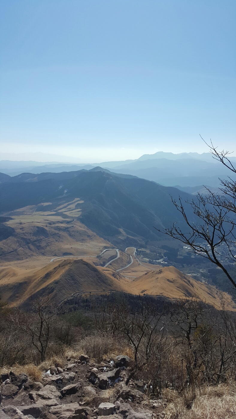
The time it takes to get to the top is about 3-4 hours, and then back down is about 2.5-3 hours, the whole way is basically a relatively steep uphill path with a little bit of flats midway up the mountain; it terms of height, it’s about 1.5km up.
Unfortunately, for this hike, Ms Buddha was not wearing the best shoes and given that the temperature reached zero about 3/4 of the way up the mountain, it became too dangerous for Ms Buddha to continue, we ended up being about 200m away from the peak altitude wise, that said, the thing I always associate with hiking and life is, you don’t know how much you’ve achieved until you look back:

Because we weren’t able to move up, we made our slow move back down with a small lunch break on the way – when we were quite a fair way down the mountain, I heard a rustle and then noticed a massive thing dart about 10m ahead of me as if to escape our company.
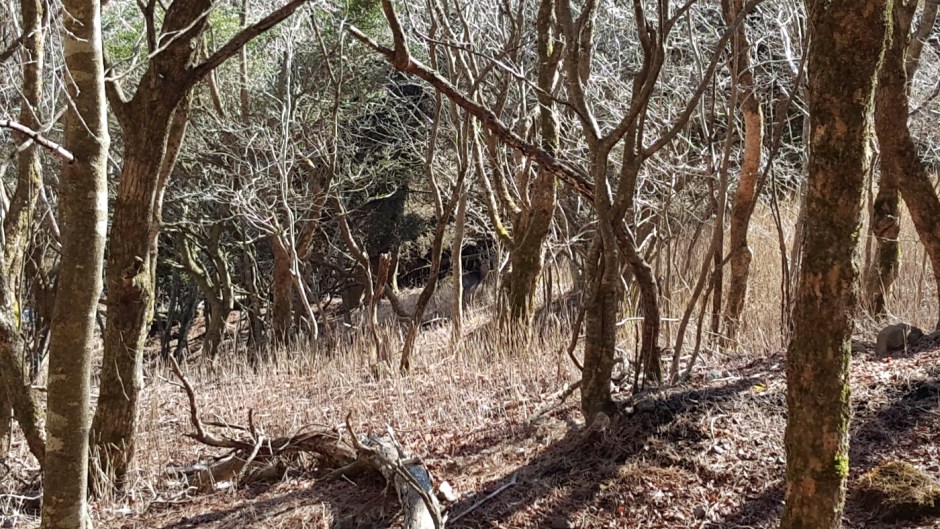
I’m someone who loves looking at different animals, in fact, Ms Buddha always wonders why the hell I love to go to Aquariums and Zoos whenever we go traveling – and to be able to spot a couple of wild deers just grazing and then running away from us was absolutely amazing!
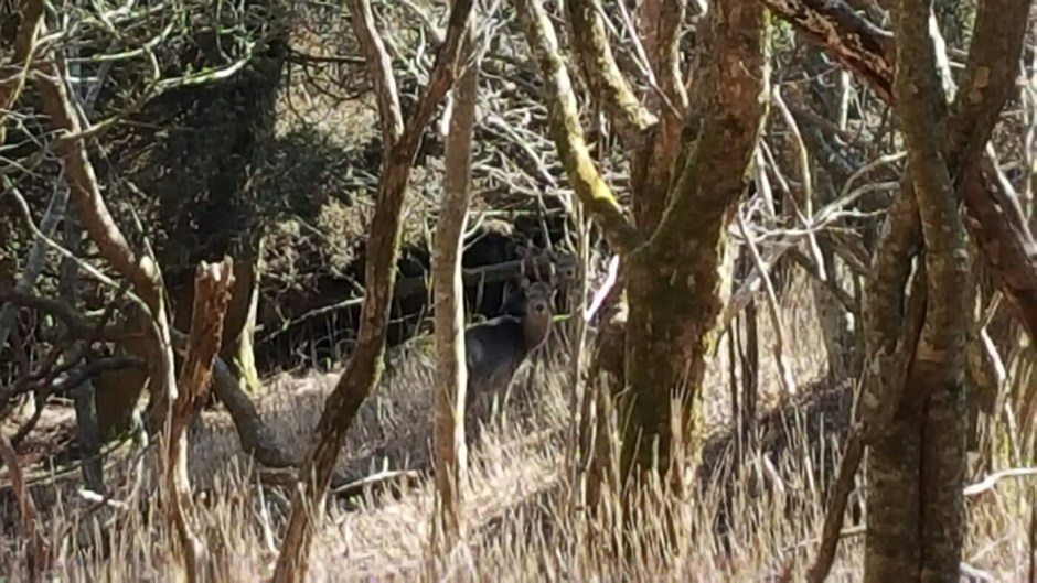
After we’ve had a bit of a stare down, we decided to continue on our path and let them continue with the grazing (because I don’t think they were going to start eating again until we left).
Although we didn’t manage to reach the peak, it was definitely an excellent experience and something that is well worth the time.

1 Comment